Maps
City map
Located at 20.48 north and 21.59' latitude and 86.16' - 87.29' east longitude, Baleswar is on the north-eastern front of Orissa.
The entire district possesses a total area of 3806 sq km.
According to the census of 2001 Baleswar has a population of 20.23 lakhs out of which 2.85 lakhs of the population is under the age group of 0-6 years.
The district, with 78, 164 hectares of irrigated land, houses many Small Scale Industries that have converted Baleswar into a prosperous industrial district.
Mahadev Baneswar, Shanty Kanan, Chandipur, Remuna, Langaleshwar, Kashaphal, Laxmannath, Chandaneswar and Talsari of Baleswar district pull huge number of tourists every year. Located in the north east part of Odisha, Baleshwar district has 81 km of coast line and is at a distance of 204 km from Bhubaneshwar. Geographically, Balasore or Baleshwar comprises of three distinct regions of the north- western hill ranges, coastal area and inner alluvial belt. The main rivers flowing through the district of Baleshwar are Jalaka, Subarnarekha, Sono, Kansabansa and Budhabalanga.

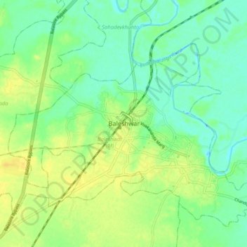
Topograhical map
Name: Balasore topographic map, elevation, terrain.
Location: Balasore, Baleshwar (M), Baleshwar, Odisha, 75001, India (21.46171 86.88167 21.54171 86.96167)
Average elevation: 14 m
Minimum elevation: -3 m
Maximum elevation: 28 m